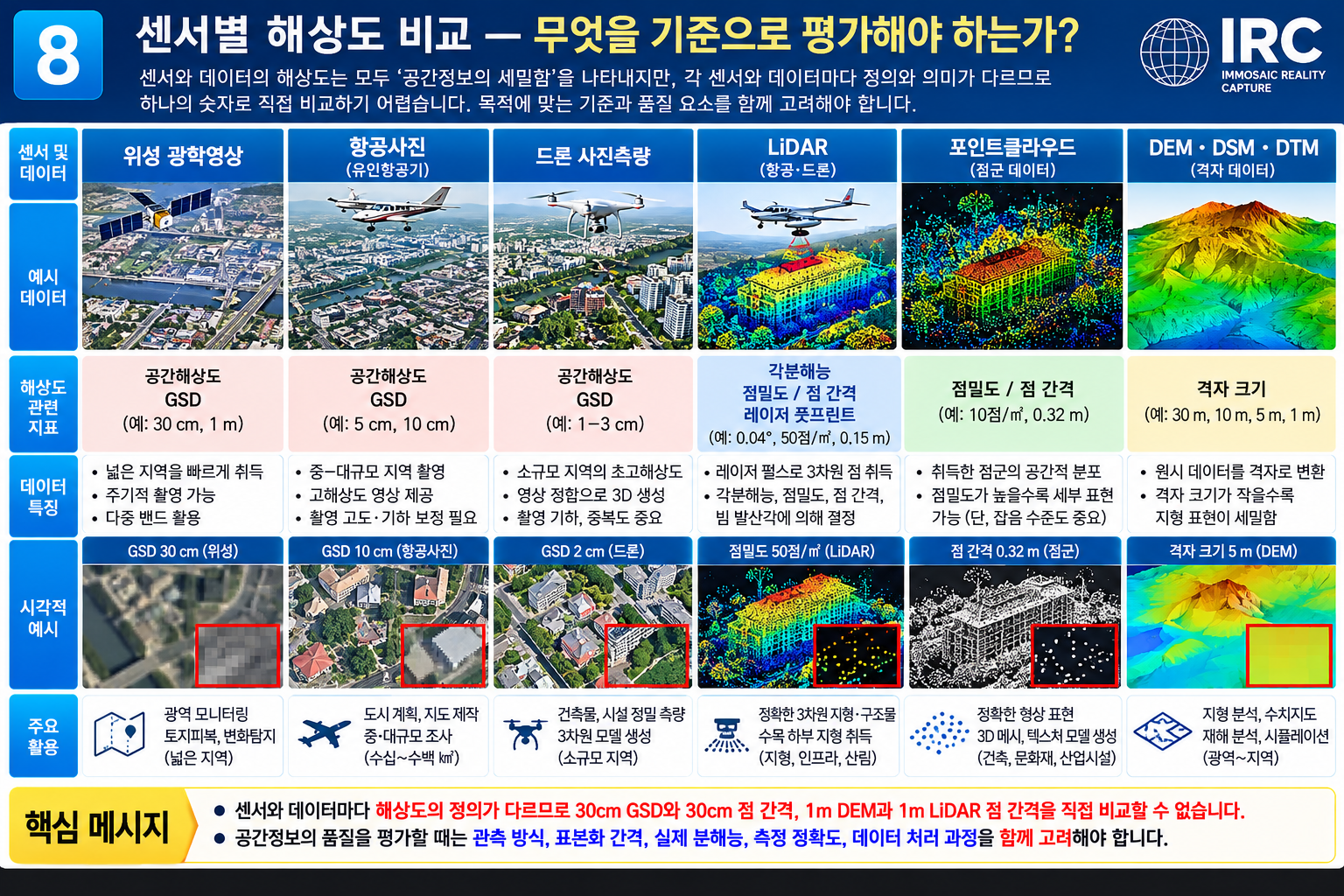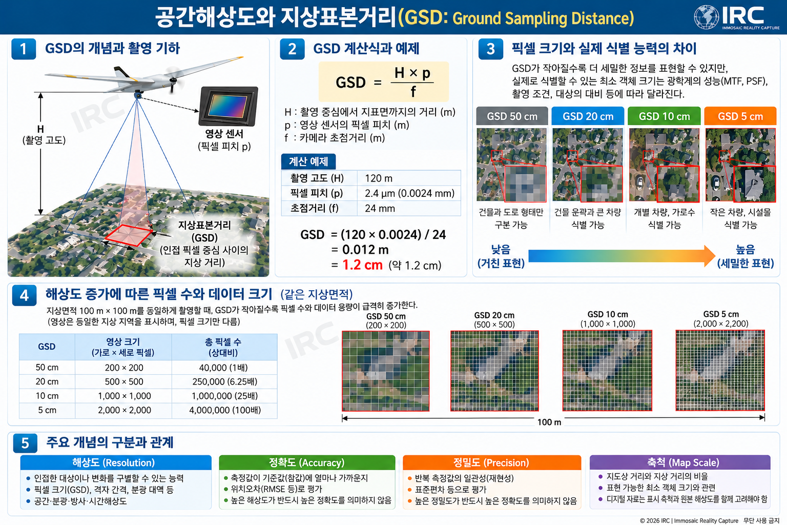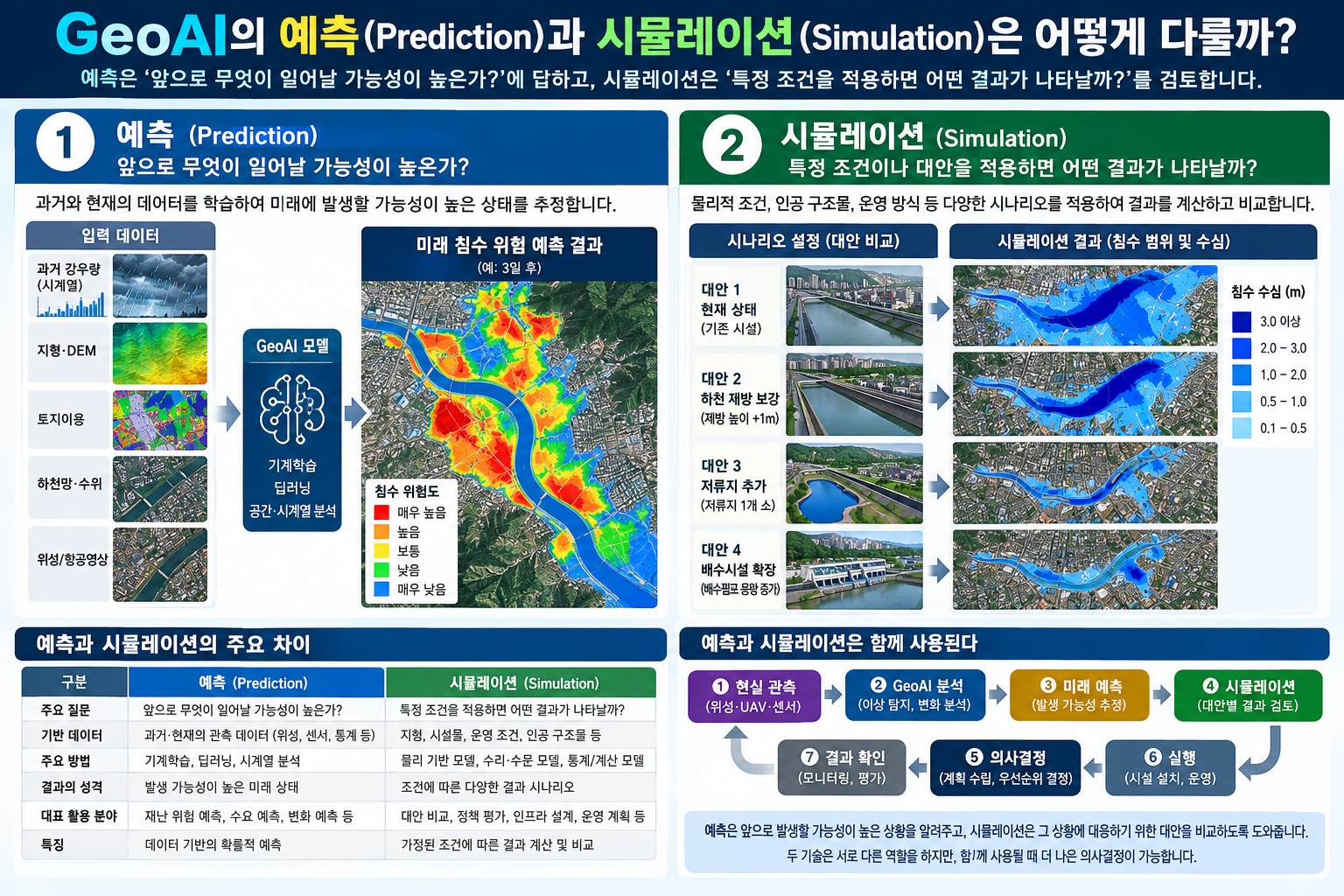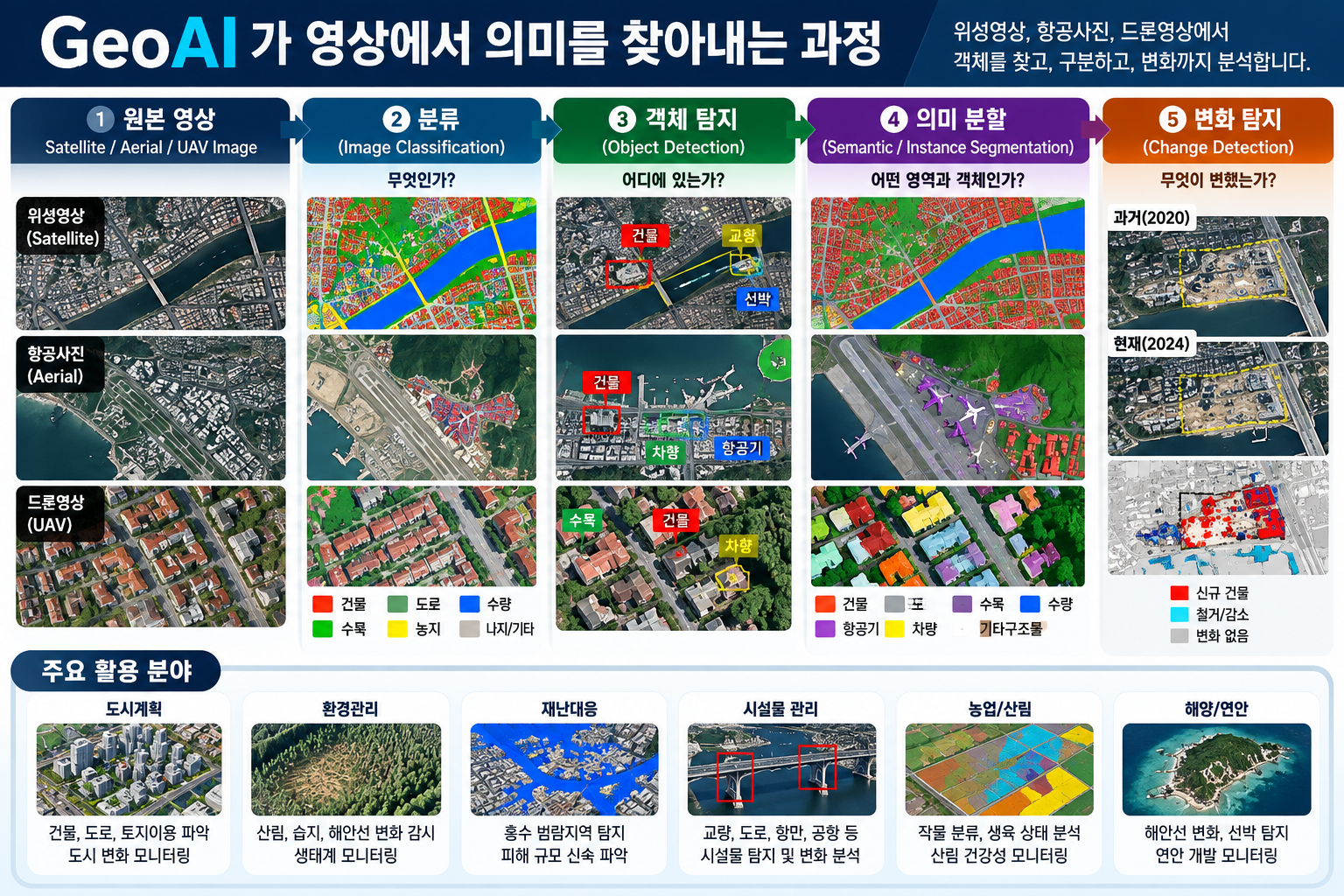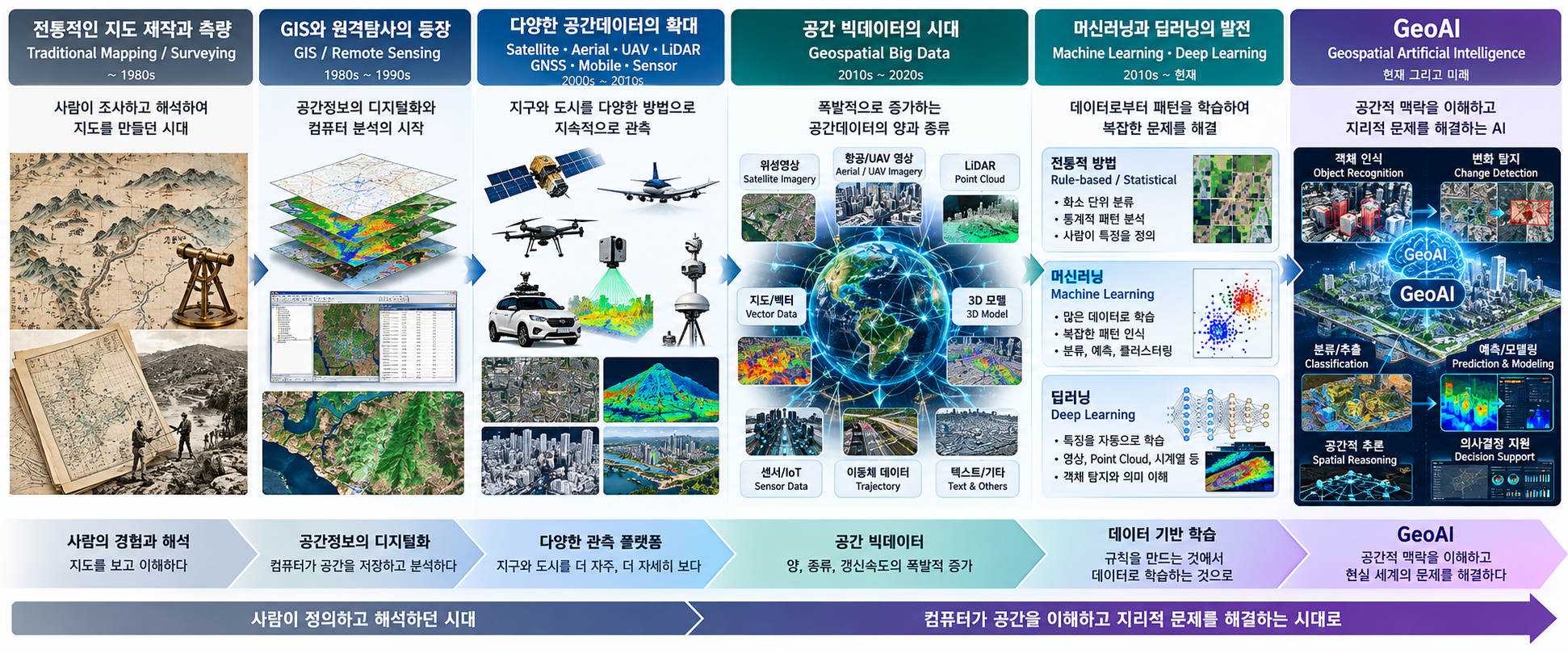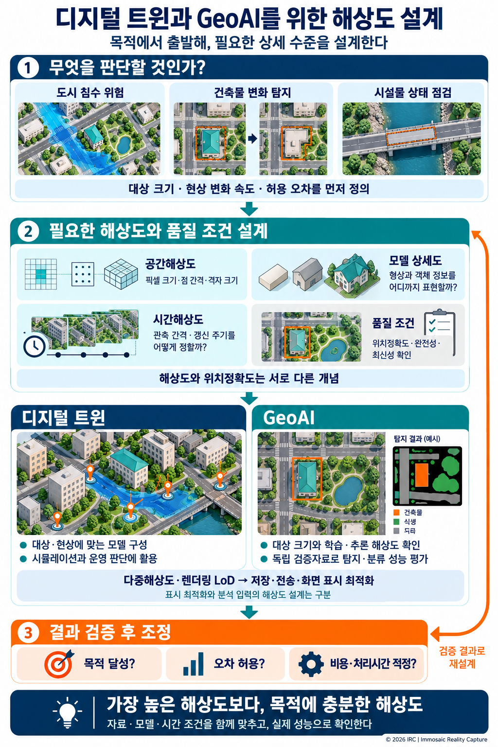

부제: 다중해상도와 LoD부터 GeoBIM, GeoAI까지 활용 목적에 맞는 공간정보 설계 전략 1. 들어가며 — 해상도는 높을수록 좋은가?공간정보 기술의 발전으로 우리는 과거보다 훨씬 정밀하고 상세한 데이터를 확보할 수 있게 되었다. 위성영상은 지표면의 작은 물체까지 관측할 수 있게 되었고, 드론 사진측량은 수 센티미터 수준의 지상표본거리(GSD)를 구현하며, LiDAR는 수많은 3차원 점을 이용하여 지형과 구조물의 형상을 표현한다. 이러한 데이터는 디지털트윈(Digital Twin), GeoBIM, GeoAI 등 다양한 분야에서 활용되고 있다. 그러나 여기서 중요한 질문이 하나 있다.과연 모든 공간정보를 가장 높은 해상도로 구축해야 할까? 도시 전체의 교통 흐름을 분석하는 데 개별 보도블록의 형..